Three areas across the country are at risk of being wiped out by a ‘mega-tsunami,’ experts are warning.
A huge 8.0 magnitude earthquake could soon hit parts of the US for the first time in more than 300 years, with the possibility of 1,000-foot-tall waves threatening to wash away communities and render them totally ‘uninhabitable.’
The alarming discovery was made by Virginia Tech which published its study in the Proceedings of the National Academy of Sciences last month.
Researchers said an earthquake could take place along the Cascadia subduction zone – a 600-mile convergent plate boundary that extends from northern California to southern British Columbia.


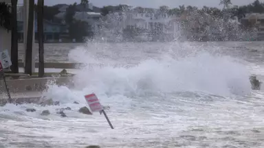
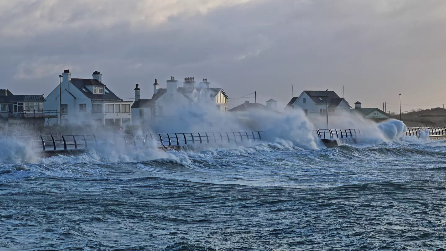
The mega-tsunami could wipe out communities (Getty Images)
Now, it has been revealed which three areas sit in the disaster zone – Alaska, Hawaii, and the West Coast of the mainland US, with the latter only recently being briefed in on the new warning.
Alaska has long been considered a hotspot for landslides due to its terrain and earthquakes.
Throw in the effects of climate change melting glaciers and reports indicate more areas of the land are becoming destabilized.
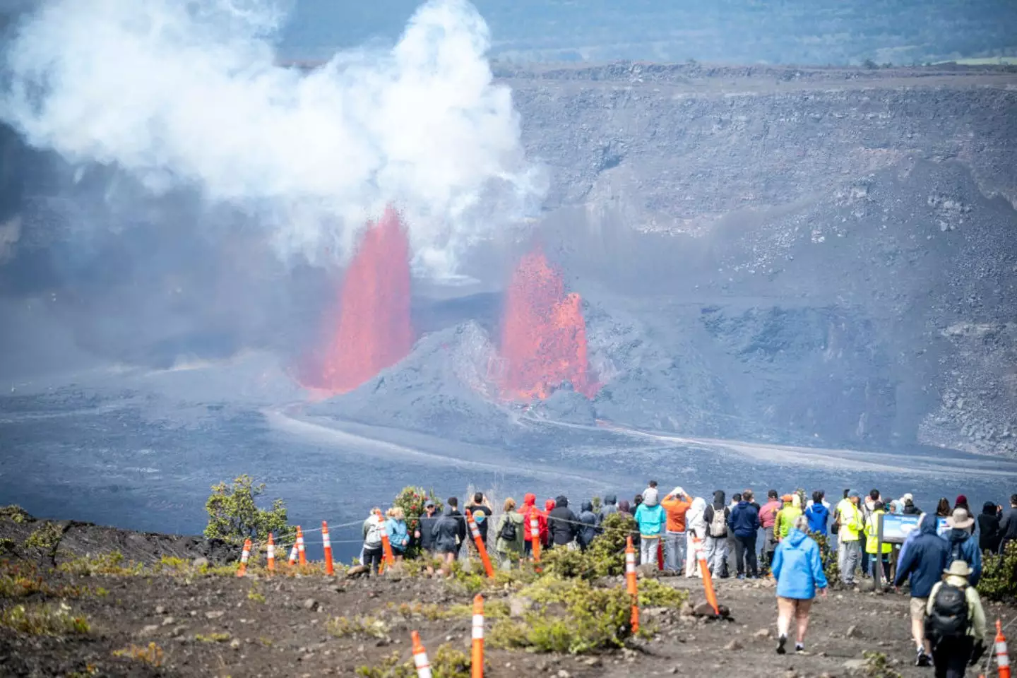

Hawaii’s Kilauea volcano has been erupting more frequently since December last year and is currently still ongoing (William Campbell/Getty Images)
Meanwhile in Hawaii, the volcanic islands have a lengthy history of suffering from mega tsunamis, caused by the collapse of volcanos with millions of rocks falling into the ocean.
The West Coast is also considered one of the most active seismic areas in North America, reports New York Post, home to the infamous ‘Pacific Ring of Fire’ which is responsible for many of the world’s largest earthquakes, tsunamis, and volcanic eruptions.
The study warns the strong earthquake coupled with rising sea levels could create the perfect storm for a mega tsunami that could make its way towards northern California, northern Oregon and southern Washington.

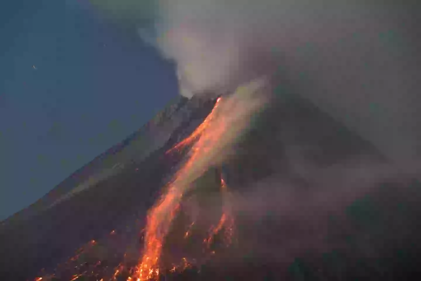
Volcanos like Indonesia’s Mount Merapi aren’t helping matters (Garry Lotulung/NurPhoto via Getty Images)
Apparently this part of the world has a 15 percent chance of experiencing an earthquake greater than 8.0 magnitude in the next 50 years.
Such a quake would also cause coastal land to sink up to 6.5 feet, the new study states.
Speaking on the concerning revelations, Tina Dura, lead author of the study and assistant professor of geosciences in the College of Science, said: “The expansion of the coastal floodplain following a Cascadia subduction zone earthquake has not been previously quantified, and the impacts to land use could significantly increase the timeline to recovery.”

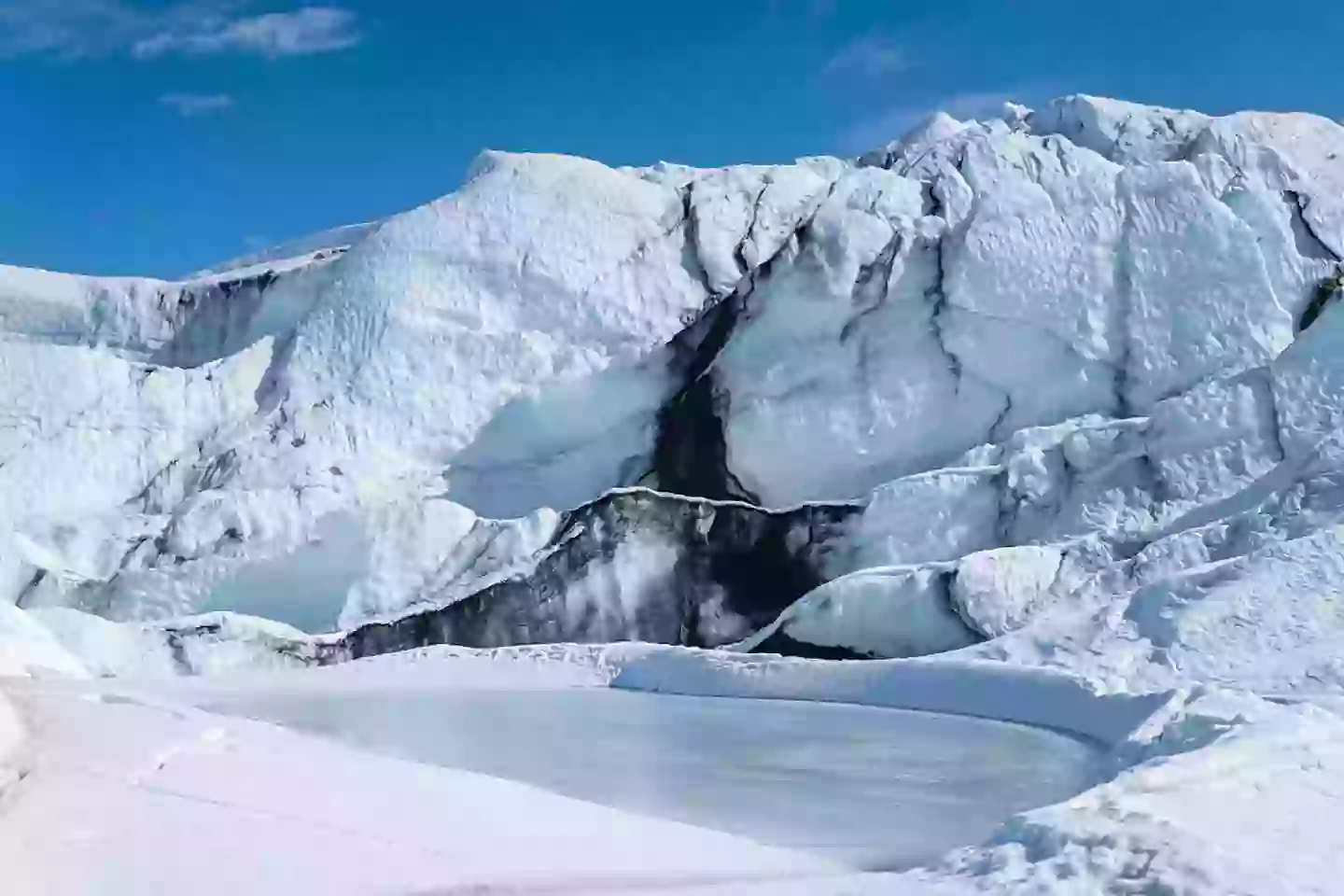
Alaska’s glaciers are melting due to climate change (Hasan Akbas/Anadolu via Getty Images)
If it were to happen today, Dura and her team estimated thousands of residents in the region of 14,350 would be impacted, as well as 22,500 structures and 777 miles of roadway would ‘fall within the post-earthquake floodplain.’
By 2100, it is predicted sea levels will rise by another three feet, increasing the risk of damage.
Dura explained: “Today, and more so in 2100 as background sea levels rise, the immediate effect of earthquake-driven subsidence will be a delay in response and recovery from the earthquake due to compromised assets. Long-term effects could render many coastal communities uninhabitable.”
However, some relief might be found in the fact such an earthquake with a seismic magnitude over 8.0 has not occurred in the region since January 1700, and Dura says the zone is not ‘super heavily populated.’
Still, there are communities that sit ‘right in the zone of subsidence,’ she added.
“This is honestly where I think the subsidence could have bigger impacts than it has during other recent large earthquakes around the world.”
Featured Image Credit: Getty Images/Joe Raedle
Topics: US News, Alaska, Hawaii, Environment, Climate Change, Science, Washington, Weather
Liv Bridge

Experts issue major warning for ‘mega-tsunami’ that could hit parts of the US
A recent study gave a bleak prediction about the chances of a huge earthquake hitting the Pacific northwest
A huge earthquake could hit parts of the US soon for the first time in over 300 years.
A new study has looked into the possibility of an earthquake greater than 8.0 magnitude hitting the Pacific northwest in the coming years, and the results are pretty concerning.
The findings by researchers from Virginia Tech were published in the Proceedings of the National Academy of Sciences last month.
The study revealed that an earthquake could occur along the Cascadia subduction zone — a 600-mile convergent plate boundary that extends from northern California to southern British Columbia.
Apparently this part of the US has a 15 percent chance of experiencing an earthquake greater than 8.0 magnitude in the next 50 years.
Such a quake would cause coastal land to sink up to 6.5 feet, explains the new study.
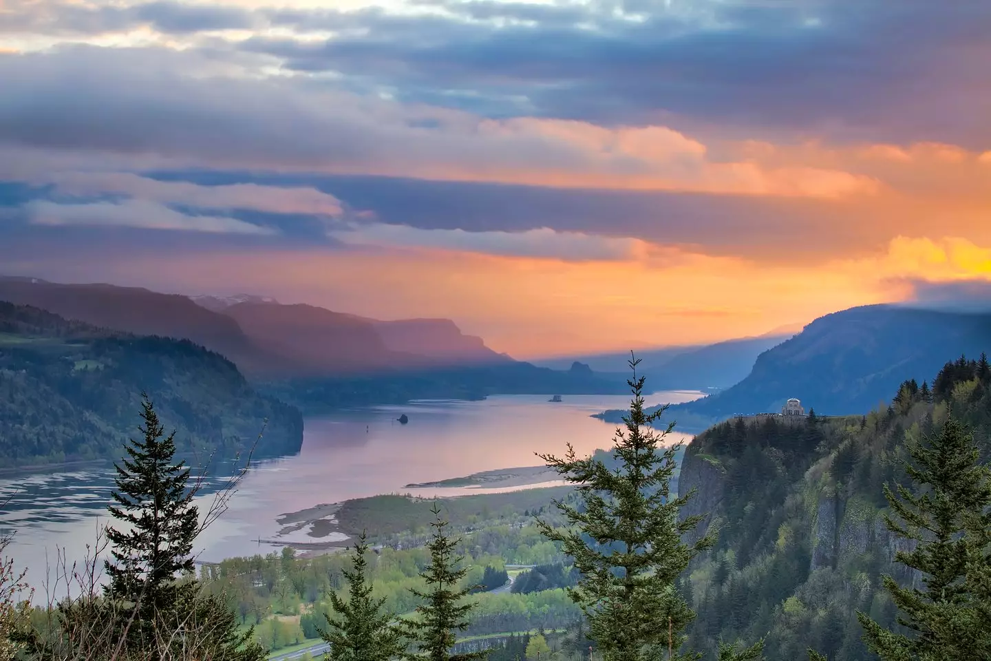

Washington’s Columbia River is part of the Cascadia Subduction Zone (Getty Stock Image)
One of the biggest earthquake of records that has happened in the US is what’s known as the Great Alaska Earthquake that occurred in 1964 and was a magnitude 9.2, says the US Geological Survey.
Speaking on the worrying revelations, Tina Dura, lead author of the study and assistant professor of geosciences in the College of Science, said: “The expansion of the coastal floodplain following a Cascadia subduction zone earthquake has not been previously quantified, and the impacts to land use could significantly increase the timeline to recovery.”
Some of the worst impacted areas would be southern Washington, northern Oregon, and northern California.
If the devastating quake were to happen today, Dura and her team estimated that ‘14,350 residents, 22,500 structures, and 777 miles of roadway would fall within the post-earthquake floodplain’.
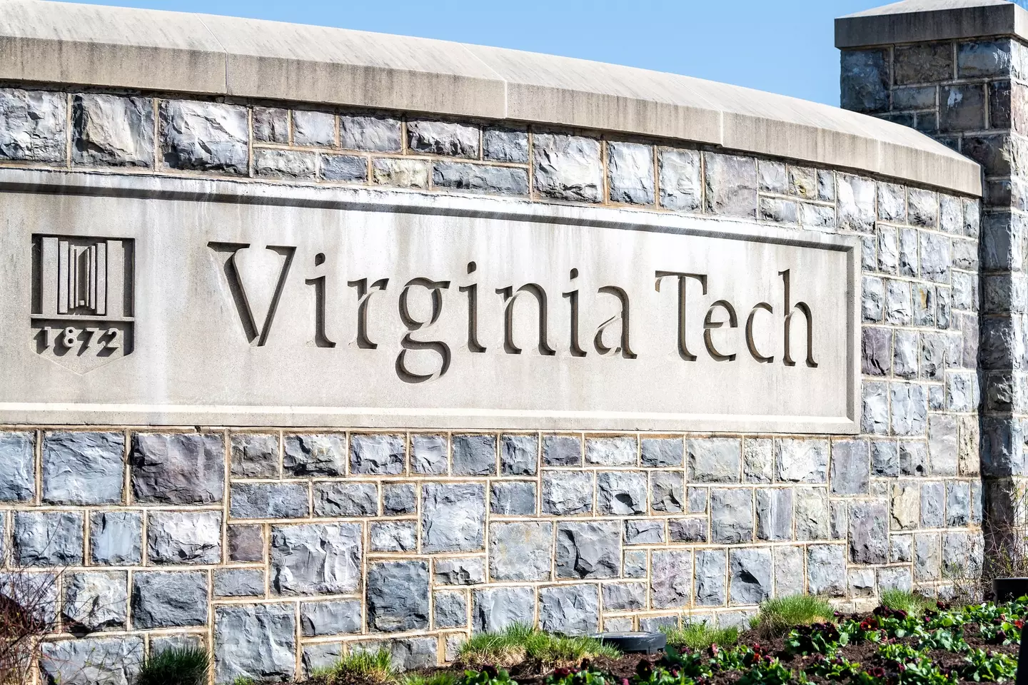

A team at Virginia Tech conducted the research (Getty Stock Image)
The Cascadia subduction zone is part of the ‘Pacific Ring of Fire’ — an area responsible for many of the world’s largest earthquakes and tsunamis.
By 2100, it’s forecast that sea levels will rise another three feet, thus exacerbating the damage.
Dura went on to warn: “Today, and more so in 2100 as background sea levels rise, the immediate effect of earthquake-driven subsidence will be a delay in response and recovery from the earthquake due to compromised assets. Long-term effects could render many coastal communities uninhabitable.”
While America has had an earthquake above the magnitude of 8.0 in recent decades, should one occur along the Cascadia subduction, it’ll be the first one in the area since January 1700.
Study authors have said that we should be preparing for such a cataclysmic event.
“Preparing for these compound hazards can minimize long-term damage, ensure resilient communities, and protect critical coastal ecosystems from permanent degradation,” the authors wrote, as per The Guardian.
Featured Image Credit: Getty Stock Image
Topics: California, News, Science, US News, Washington
Niamh Shackleton

Horrifying map shows the surprising areas in US which are most at risk of wildfires
The longterm forecast is pretty scary.

After Southern California was devastated by wildfires earlier this year, studies have revealed that some areas of the US are at greater risk than others.
Recent incidents have been proving that blazes are becoming more frequent, with the peak month remaining August.
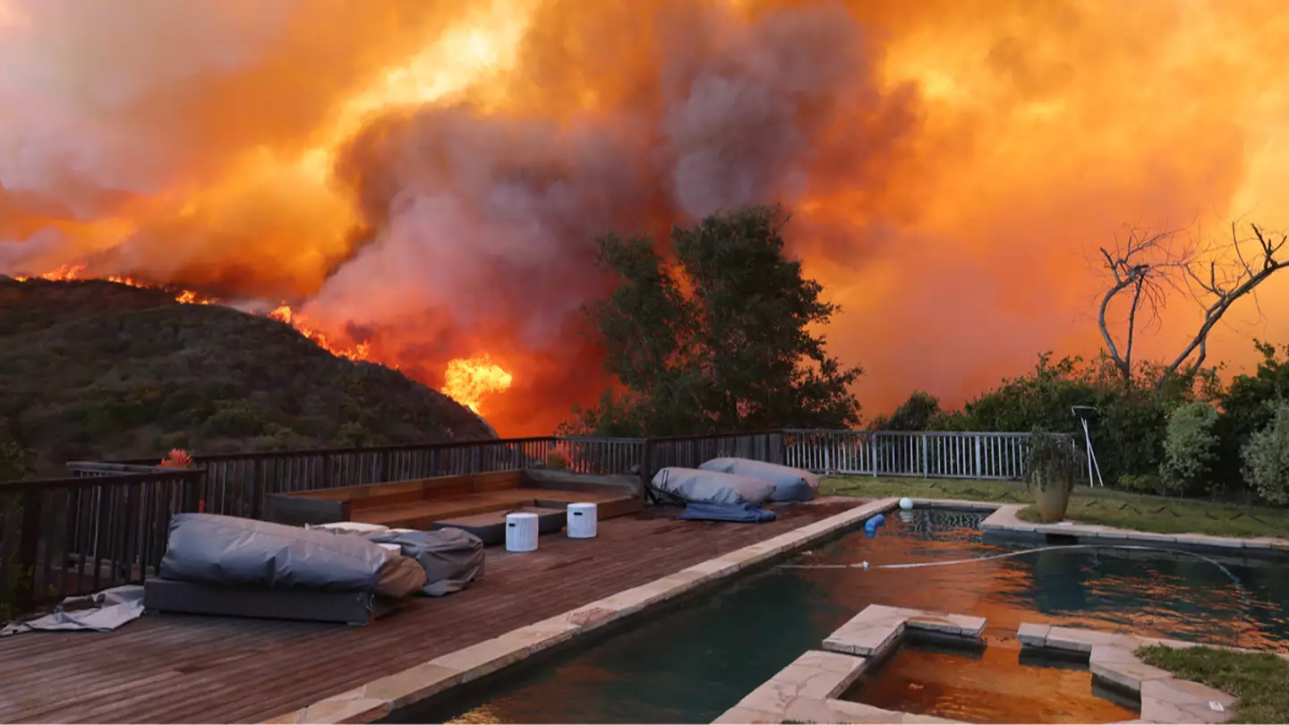
Large areas of California were engulfed in flames at the beginning of 2025, resulting in a death toll of 30 people and forcing more than 200,000 residents to evacuate.
But California’s wildfires weren’t an isolated occurrence, as a fire also recently erupted in New Jersey, causing hazardous air quality across the state and in New York.
Published earlier this week, research by AccuWeather shows longterm forecasts with a terrifying prospect of seeing between 7 and 9 million acres will burn across the United States, above the historical average of 7 million.

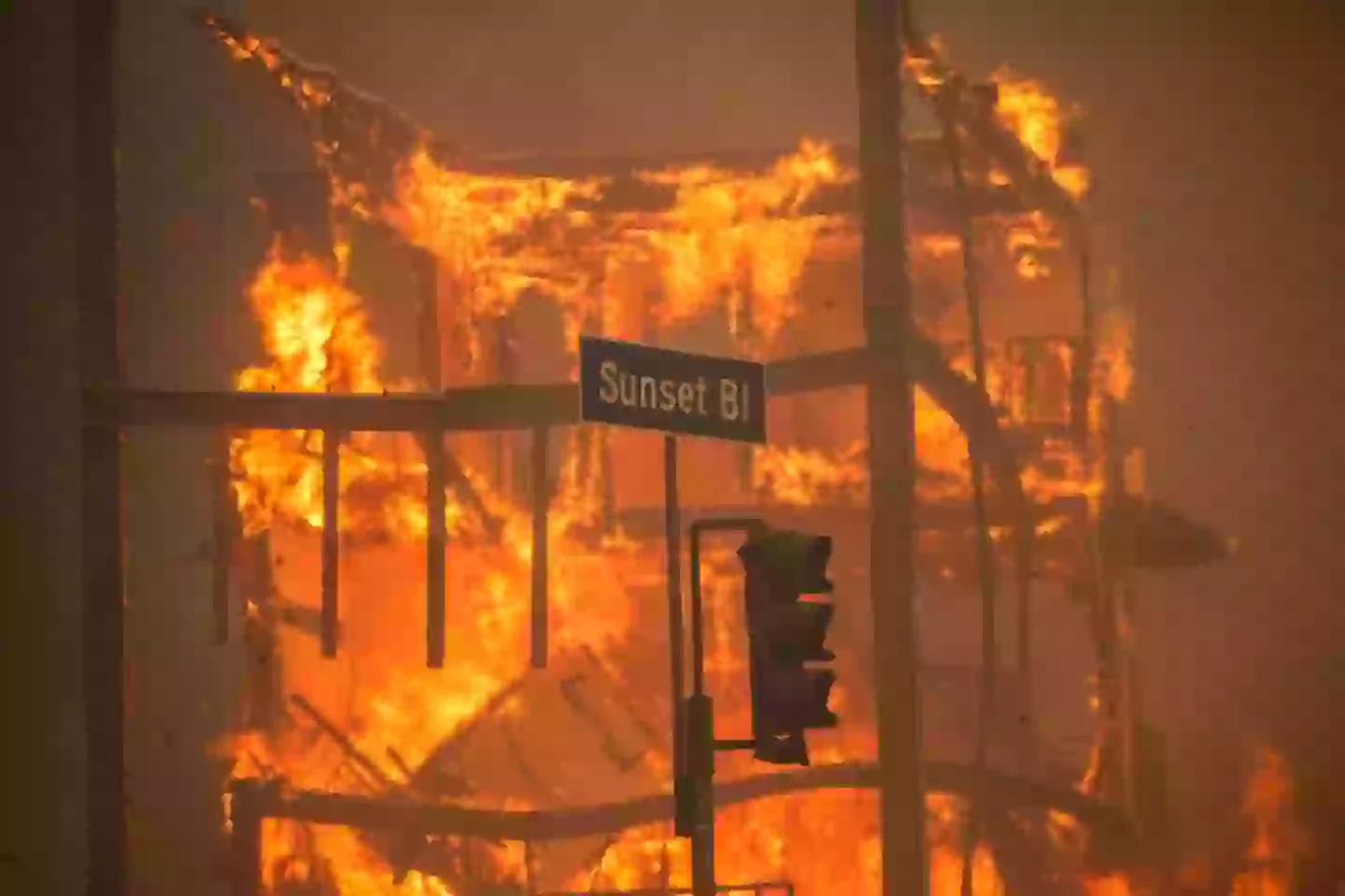
Wildfires devastated Southern California in January 2025, exacerbated by drought conditions and the Santa Ana winds sweeping through the region (Apu Gomes/Stringer/Getty)
There are estimated to be between 60,000 and 75,000 fires across the country this year, with 7,500 to 9,000 expected to erupt in California alone.
The research has also explained why spring fires are becoming a threat. While the summer and autumn months are usually more impacted by fires, drought conditions can mean that fires could occur in certain areas even during the spring.
In response to the emergency, AccuWeather has created a map of the US areas at higher risk of fires, with the Southern Plains and interior Southwest being identified as fire-prone zones.
“Despite a few early spring storms, drought conditions remain deeply entrenched,” senior meteorologist Paul Pastelok said.
Fires could burn more than 7 million acres in 2025 as the United States faces a volatile year for wildfires. bit.ly/4jEmWBc
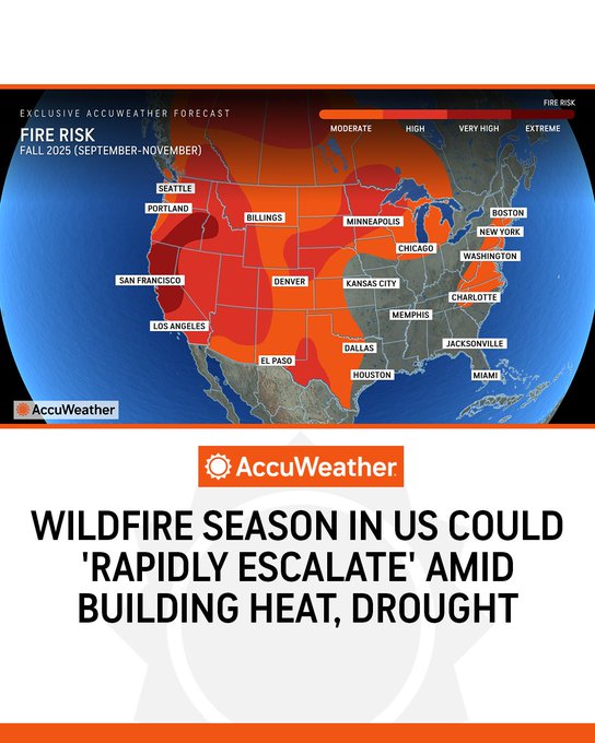
“Dry, windy and low-humidity days are expected to be frequent across the region, leading to rapid drying of available fuels and an increased number of high-risk wildfire days.”
Pastelok added: “While the season may start slowly, there is strong potential for rapid escalation as drought conditions and heat set in.”
The fire danger may have decreased, especially in parts of eastern Texas, Arkansas and southeastern Oklahoma, but there’s still a chance of additional fires sparking through the remainder of the spring.
In the summer months, shifting weather conditions could cause for a surge in wildfire activity, especially across the Northwest and northern Rockies.
“While the season may start slowly, there is strong potential for rapid escalation as drought conditions and heat set in,” Pastelok said.

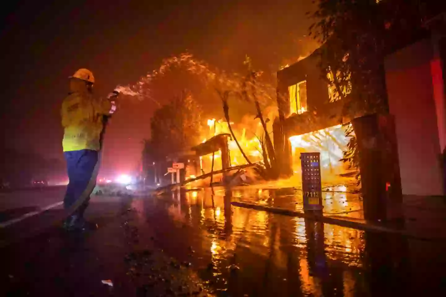
Wildfires are most likely to erupt in the summer, with August being the peak month (Apu Gomes/Stringer/Getty)
Risk remains high for Southwestern states facing monsoon rains early on in the summer, particularly when lightning from the storms strike on a dry landscape, potentially causing fires.
Later in the monsoon season, rains could be a deterrent for fires, as AccuWeather Meteorologist Brandon Buckingham explained.
“As summer progresses, repeated rounds of monsoon rains and elevated humidity should help suppress wildfire development, particularly in Arizona, western New Mexico and southern Utah,” Buckingham said.
Other states should watch out, too, according to the meteorologist.
“Dry stretches with below-normal thunderstorm activity can lead to temporary flare-ups, especially in the Carolinas, parts of Georgia, Florida and the Gulf Coast,” he said.
Meanwhile, the trees downed during a late-March ice storm could also temporarily increase the risk of fires in northern Michigan and northeastern Wisconsin in the summer and autumn months.
Featured Image Credit: Getty Images/DAVID SWANSON
Topics: Wildfires, Climate Change, Environment, US News, Weather
Stefania Sarrubba

Experts say Hurricane Milton is set to be so powerful it could change Florida’s coastline forever
Hurricane Milton is predicted to be one of the most powerful storms to strike Florida
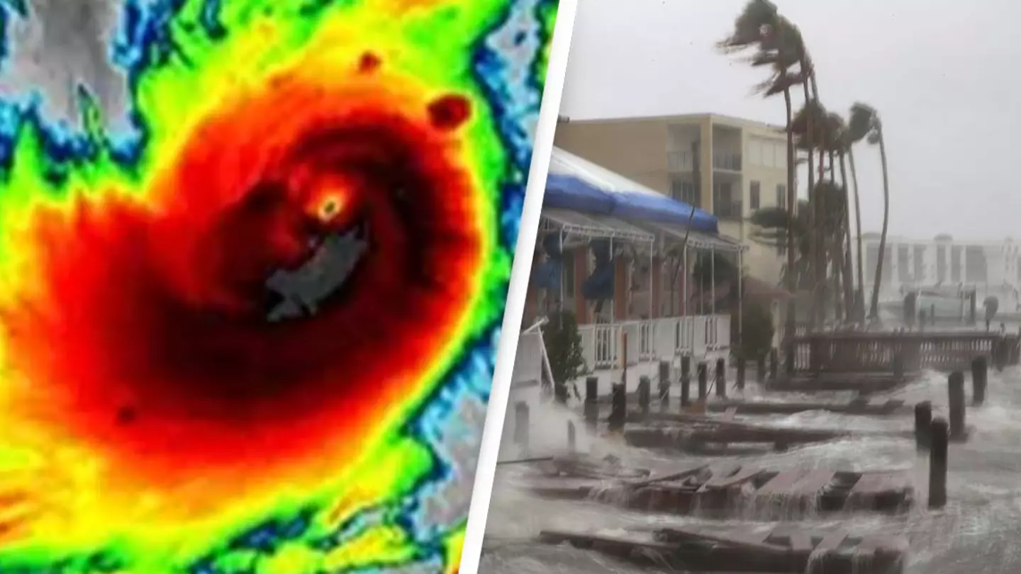
Hurricane Milton is expected to be wreak havoc when it hits Florida, potentially changing the coastline of the state permanently.
The US Geological Survey agency explained just how severe the storm is set to be, and the lasting impact it will have on the region.
Milton is set to strike the Sunshine state late on Wednesday evening (October 9) or early Thursday (October 10), and at least 95 percent of Florida’s west coast beaches are going to be overwhelmed or covered by ocean water when the storm makes landfall.
The government agency warned: “This is the most severe level of coastal change.”
They added that ‘Milton’s waves and surge’ could cause ‘erosion and overwash’ to all of the state’s beaches.
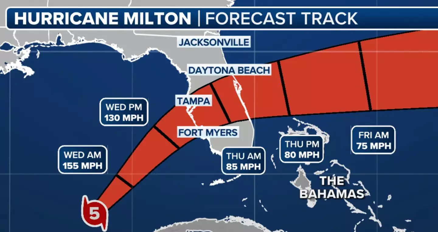

Hurricane Milton is expected to devastate Florida when it makes landfall (Fox Weather)
The powerful hurricane could prove to be so devastating, it could permanently change the state’s coastline, according to experts.
USGS scientist Kara Doran also stated: “The significance of the coastal change forecast for Milton’s impact to the Florida west coast cannot be overstated.”
Meteorologists and scientists have also been urging people to take the threat of the storm seriously, insisting it is one of the most powerful.
Tampa mayor Jane Castor took to CNN earlier this week to warn that those in evacuation zones that attempt to ride out the storm would die.
The US National Hurricane Center (NHC) progressed hurricane Milton to the top category on the Saffir-Simpson Hurricane Wind Scale earlier this week.
Category five is stated as seeing winds at speeds of ‘157 mph or higher (252 km/h or higher)’, with ‘catastrophic damage’ occurring.
It details: “A high percentage of framed homes will be destroyed, with total roof failure and wall collapse. Fallen trees and power poles will isolate residential areas. Power outages will last for weeks to possibly months. Most of the area will be uninhabitable for weeks or months.”
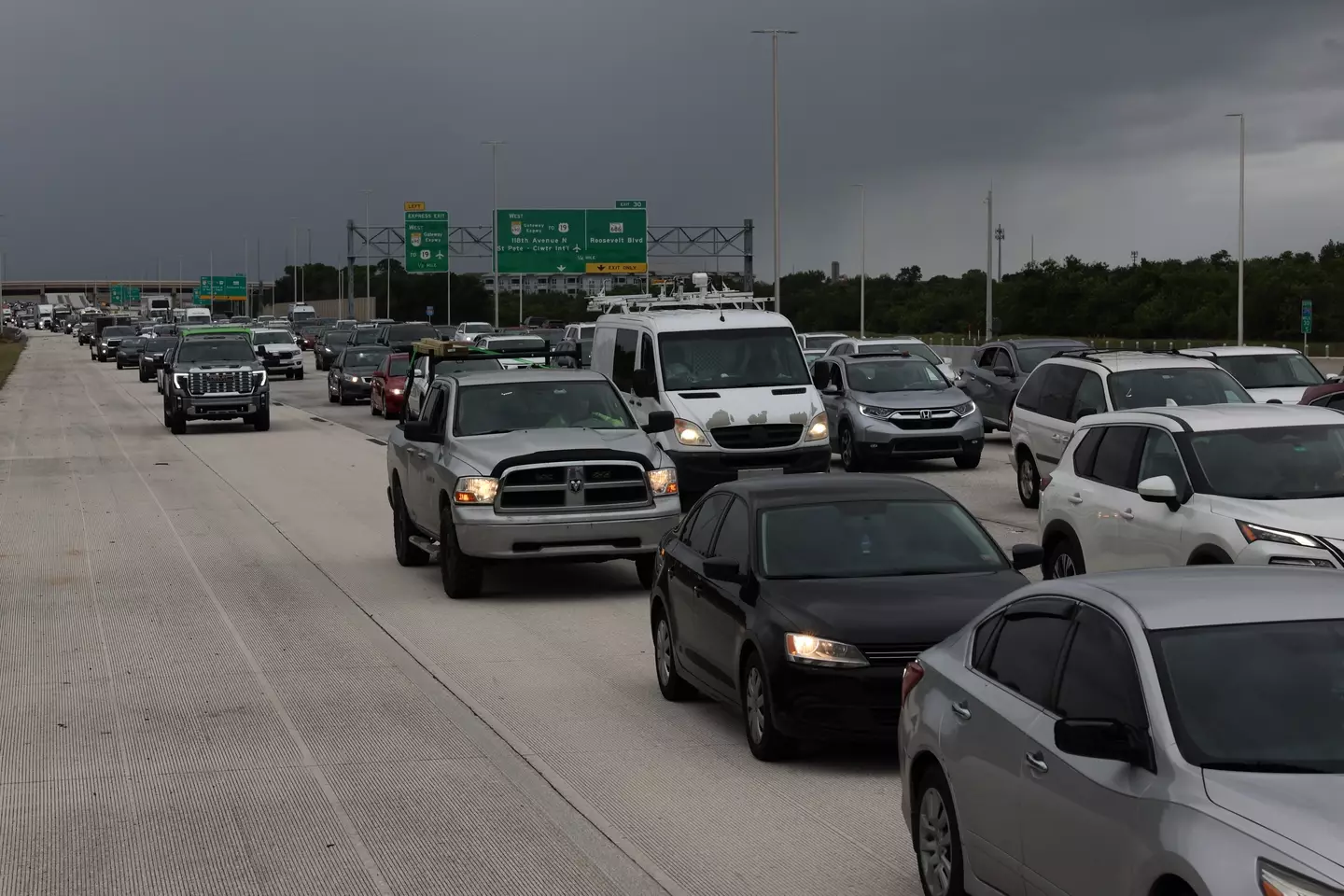

People in evacuation zones have been warned against attempting to ride out the storm (Spencer Platt/Getty Images)
By Monday evening, the hurricane’s winds reached 180mph – well above that of category five of the scale.
While the hurricane has since decreased to a category four, concerns are mounting it could go beyond category five once again. Due to the severity of the hurricane, there have been calls for a new scale to help categorize storms of this strength.
Speaking on social media, Professor Michael E. Mann stated: “A compelling argument has been made that a hurricane with sustained wind speeds of 192mph or greater should be considered ‘category 6’.
“There is some speculation that #Milton might have actually breached the 192 mph ‘cat 6’ cutoff. Stay tuned…”
However, Fox Weather meteorologist Mike Rawling told the Post he is not aware of any new scale being created and said, at this point, a category six is unnecessary.
Featured Image Credit: NOAA / Mark Wilson/Getty Images
Topics: Climate Change, Florida, Science, US News, Weather, Hurricane Milton
Gerrard Kaonga

‘Unrestricted’ US park found by expert with areas as radioactive as Chernobyl
It is alleged that parts of the park are just as radioactive as Chernobyl in Ukraine
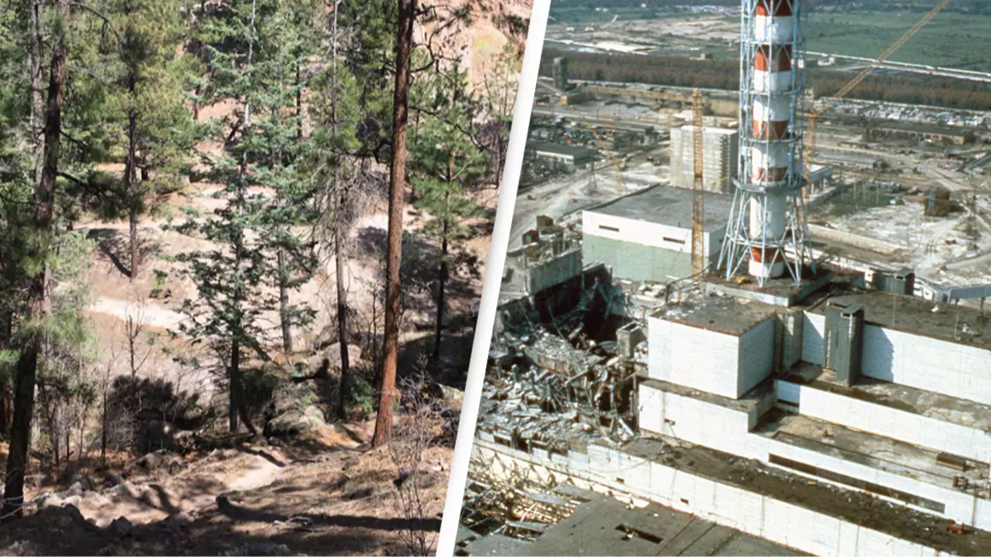
Believe it or not, there’s a park in the US that residents have ‘unrestricted’ access to and parts of it are allegedly as radioactive as the infamous Chernobyl.
While Area 51 is highly guarded and ‘use of deadly force is authorized’, there is one place here in the US that poses a danger to life in a completely different way.
The connection? There is none.
Yes, there is no relation, it’s just striking how a spot that is as radioactive as Ukraine’s Chernobyl has nothing preventing anyone from strolling into the area and coming back mutated, while there is a place in the desert where we can’t take pictures.
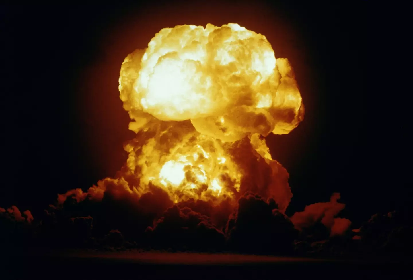

A US Navy nuclear test (Getty Stock Image)
Anyway, let’s get into it.
If you’re from the US, you’ve probably heard of Acid Canyon in New Mexico. It’s a hiking trail near to Los Alamos, which is where the atomic bomb was developed and created.
It has been alleged that for more than 20 years, the US Government would dump radioactive waste into Acid Canyon.
The US Department of Energy said: “From 1943 to 1964, nuclear weapons research activities at Los Alamos National Laboratory (LANL) produced liquid effluent wastes from general laboratory, chemistry, and radiochemistry operations.
“By 1951, a treatment plant was constructed on the south rim of Acid Canyon to remove plutonium and other radionuclides from the waste streams originating from the original main laboratory technical area (TA-1).
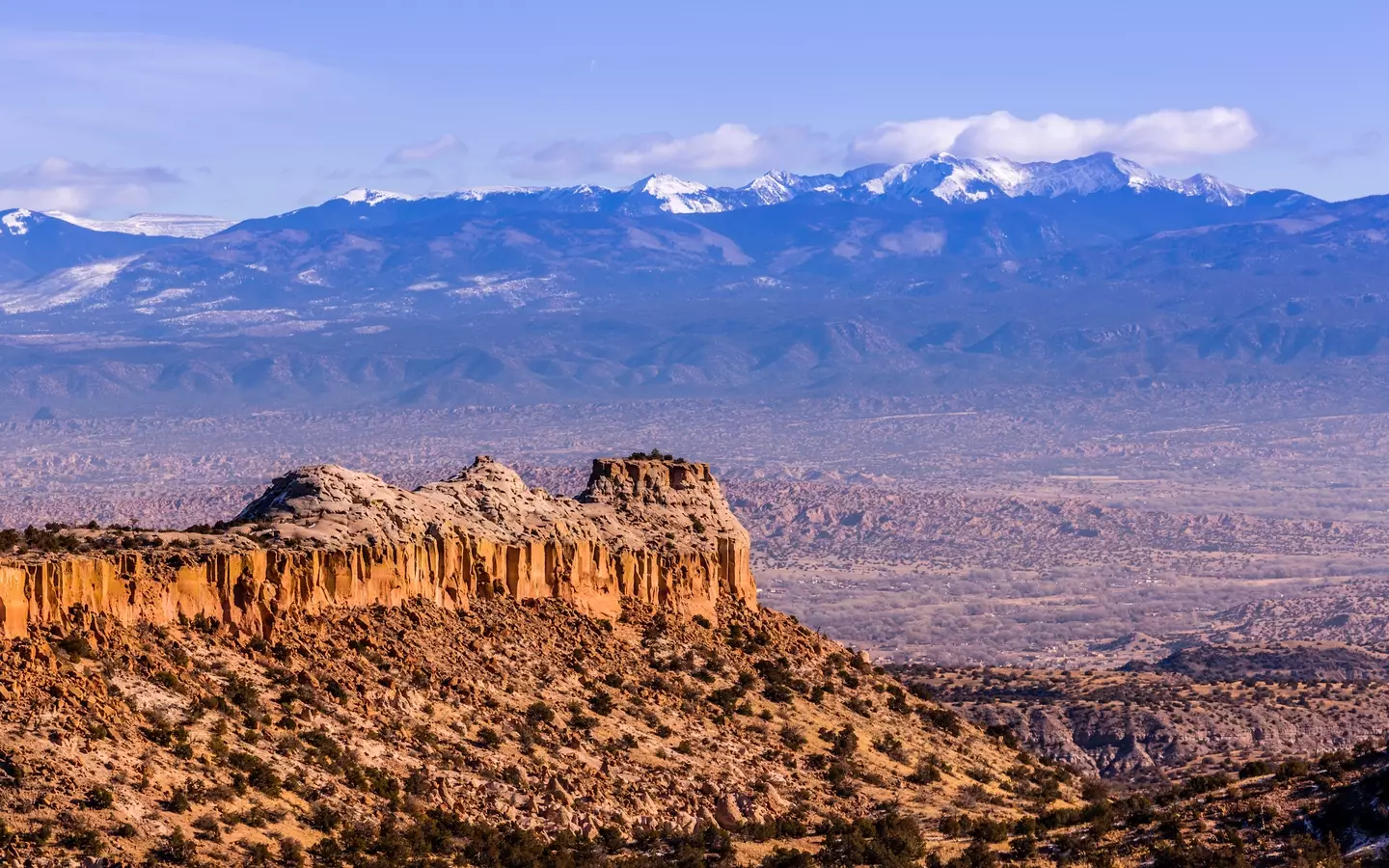

Rocky Mountains as seen from Los Alamos, New Mexico (Getty Stock Image)
“The treated and untreated wastes were discharged from the main acid sewer line, which terminated at the head of the south fork of Acid Canyon.”
They added: “In 1953, a new plutonium research laboratory complex began piping additional radioactive liquid wastes to the treatment plant.
“If treatment was not necessary to meet release criteria in effect at the time, the raw waste was discharged directly to Acid Canyon.
“In 1958, liquid wastes from a new radiochemistry facility were added to the treatment plant’s load. Wastes were finally redirected to a new central waste treatment plant in 1963, and the last releases to Acid Canyon occurred in June 1964.”
That is 21 years of toxic waste being dumped on the land, so obviously it has damaged the land.
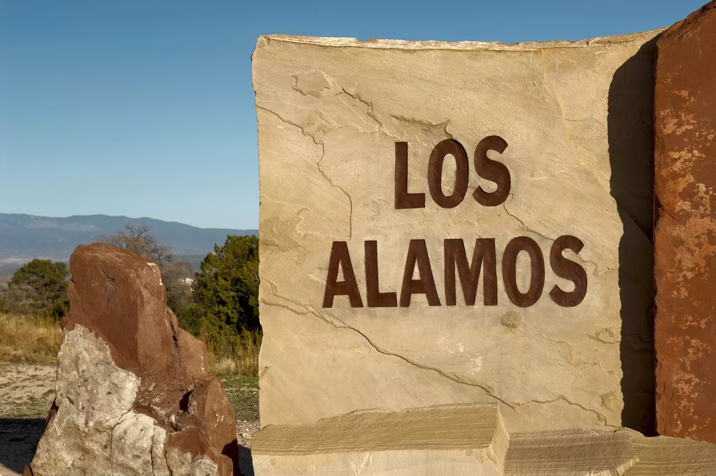

Los Alamos is the birthplace of the atomic bomb (Getty Stock Image)
In July, data was collated by biochemist Michael Ketterer, a professor at Northern Arizona University.
Speaking publicly about his findings, he told the Guardian: “I’ve never seen anything quite like it in the United States. This is an unrestricted area.
“It’s just an extreme example of very high concentrations of plutonium in soils and sediments.”
He explained that the radioactive plutonium has leaked into ground water which will be absorbed by plants and will then be eaten by grazing animals, or even spread through the air as wildfires become more common due to climate change.
He added: “This is one of the most shocking things I’ve ever stumbled across in my life.”
Featured Image Credit: U.S Department of Energy / Igor Kostin/Laski Diffusion/Getty Images