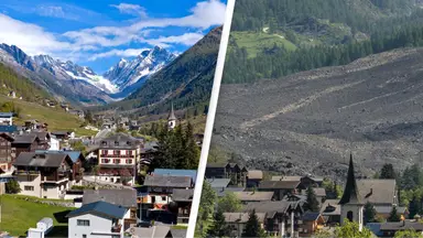
A village has been left almost completely destroyed after a glacier collapsed onto it.
The glacier in question crashed down a Swiss mountainside onto Blatten and sent plumes of dust into the sky, leaving nearly all of the Alpine village coated in mud.
Blatten, in the southern Lötschental valley, was home to around 300 people, all of whom were advised to evacuate their homes earlier this month out of fears of the glacier’s imminent demise.
Stephane Ganzer, the head of security in the southern Valais region, has described the incident as ‘a major catastrophe’ and confirmed that around 90 percent of the village as been lost to the glacier landslide, NBC News reports.
The regional government said in a statement that a large chunk of the Birch Glacier above the village had broken off, causing the landslide, which also buried the nearby Lonza River bed, raising the possibility of dammed water flows.
.jpg)
.jpg)
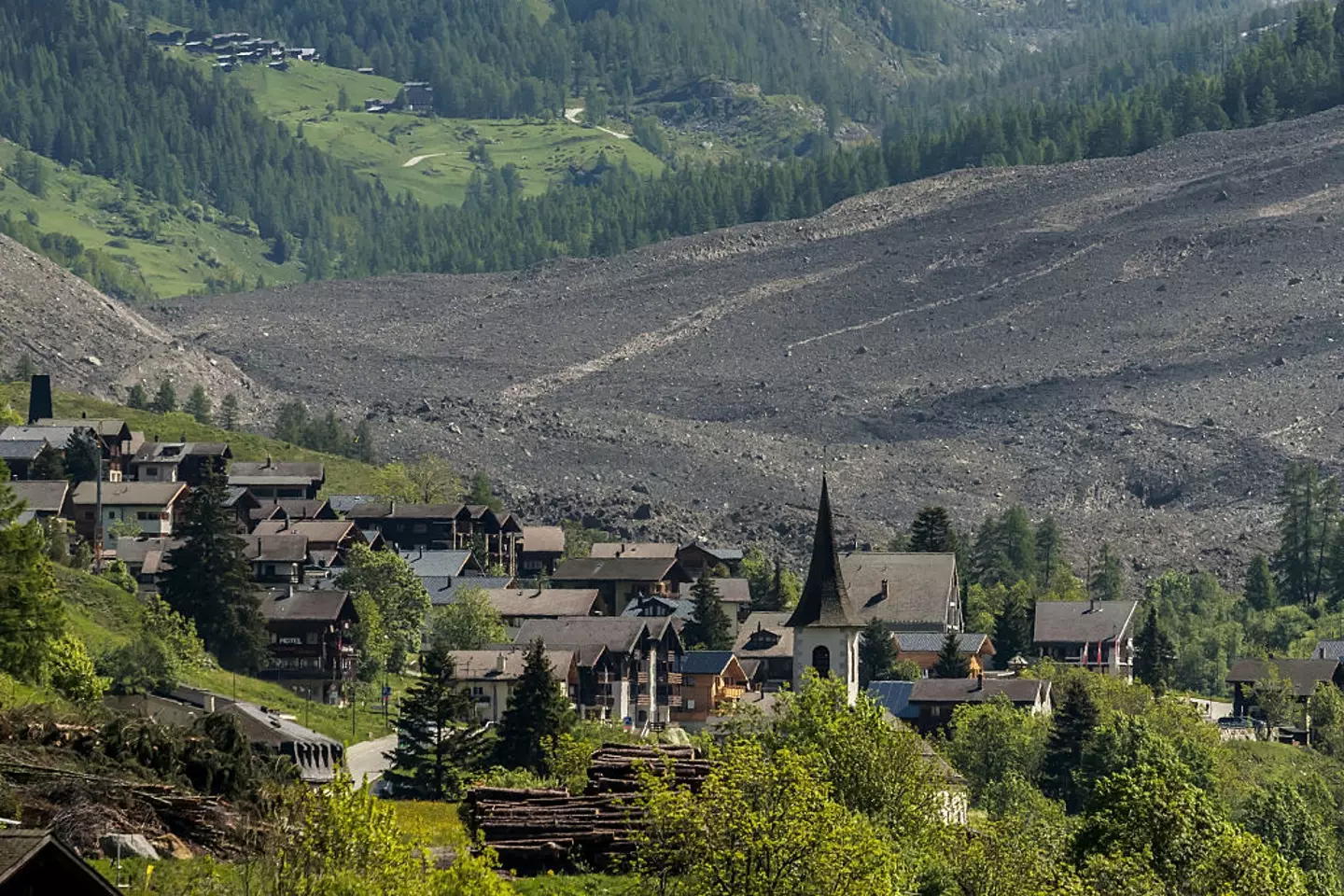
Blatten in Lötschental valley seen before the glacier collapse (Getty Stock Image)
After weeks of worries, the glacier collapsed yesterday (May 28) just days after Blatten’s residents and their livestock were told to leave the area on May 19.
Swiss glaciologists have repeatedly expressed concerns about a thaw in recent years – attributed in large part to climate change – that has accelerated the retreat of glaciers in Switzerland.
The landlocked Alpine country has the most glaciers of any country in Europe, and saw four percent of its total glacier volume disappear in 2023. That was the second-biggest decline in a single year after a six percent drop in 2022.

90 percent of the village has been lost to the landslide (FABRICE COFFRINI/AFP via Getty Images)
It isn’t thought anyone has died in the incident but a 64-year-old man has been reported missing.
The Cantonal Police of Valais said that a search and rescue operation was under way for the man, whose name has not been made public, and it involved a drone with a thermal camera.
Heartbreaking images show the aftermath of the collapsed glacier. In before photos you see green grass, blue skies and beautiful lodges nestled into Lötschental valley, but now Blatten is a sea of brown as a result of the landslide caused by the glacier and only few homes survived its collapse.
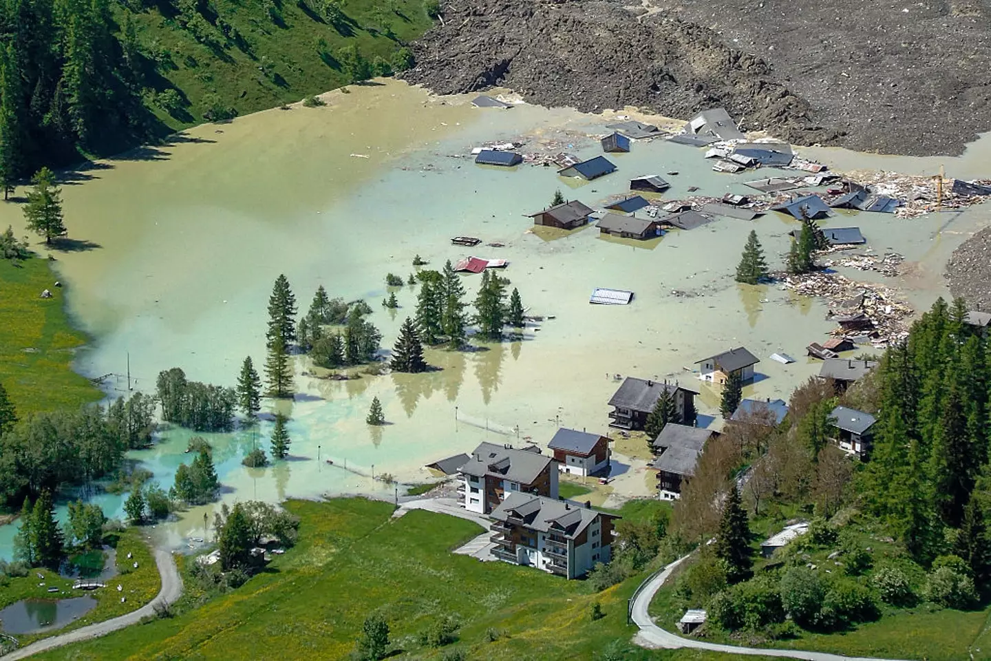

Glacier debris is now blocking the river Lonza (ALEXANDRE AGRUSTI/AFP via Getty Images)
In an emotional statement, Blatten’s mayor, Matthias Bellwald, said that ‘the unimaginable has happened’.
He continued, as per BBC News: “We have lost our village, but not our heart. We will support each other and console each other. After a long night, it will be morning again.”
It’s believed that climate change triggered loosening in the rock mass in the permafrost zone, which then contributed towards the glacier’s collapse.
Matthias Huss, head of the Glacier Monitoring in Switzerland (GLAMOS), told Reuters: “Unexpected things happen at places that we have not seen for hundreds of years, most probably due to climate change.”
Many of Switzerland’s glaciers have thawed in recent years, one being the Aletsch glacier.
As a result of the ice caps melting, a 50-year-old mystery was solved last year after the the wreckage of a plane crash that took place in 1968 near the Jungfrau and Mönch mountain peaks was discovered.
Featured Image Credit: Gunter Fischer/UCG/Universal Images Group via Getty Images / FABRICE COFFRINI/AFP via Getty Images
Topics: Climate Change, Environment, World News, News, Europe
Niamh Shackleton
.webp)
.webp)
Scientists alarmed by discovery after sending robot under the ‘Doomsday Glacier’
Experts warned that a glacier the size of Florida is ‘in trouble’
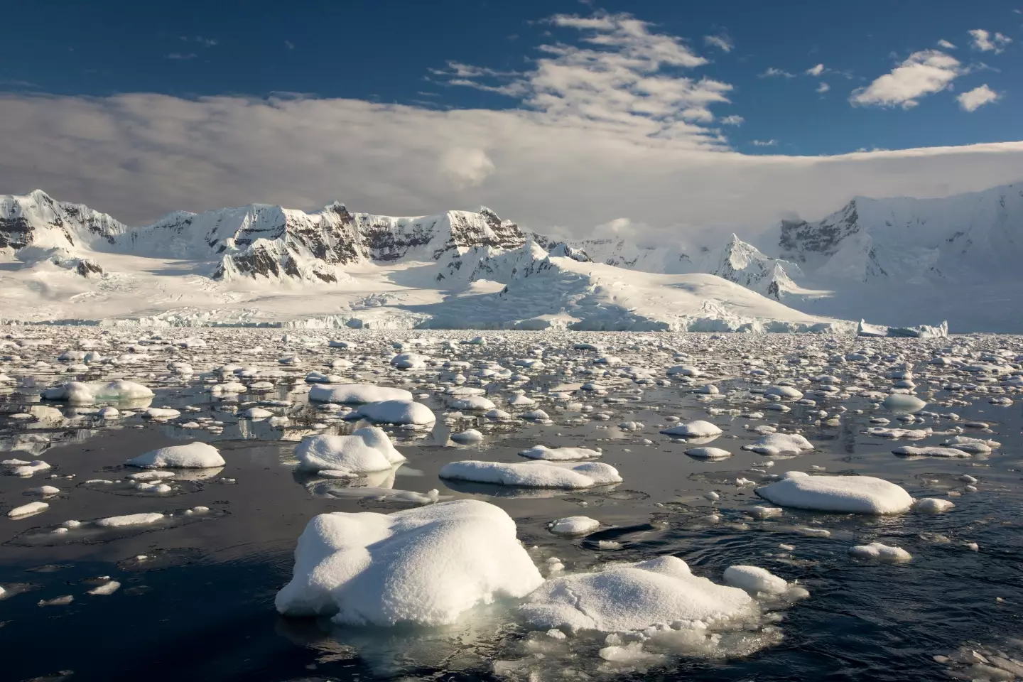
If you thought the Doomsday Clock was something to worry about, then you’ll want to hear about some recent findings about the Doomsday Glacier.
The glacier, officially known as Thwaites Glacier, is located in West Antartica and gets its nickname from the impact it could cause on the globe’s sea levels.
In comparison to 20,000 years ago, sea level has risen by more than 125 metres (410 ft) as a result of global warming, and the Doomsday Glacier alone holds enough ice to raise the ocean by 3.3 meters.
Over the last 100 years, global temperatures have risen about 1°C. While it doesn’t sound like much, it’s having detrimental impacts on our planet.
Researchers at the site of the Thwaites Glacier – which is said to be the size of Florida – previously found that deep cracks are forming on the shelf, which helps keep the glacier in one piece.
It was said that these cracks were degrading at a concerning rate, so scientists sent a robot deep down into the icy surface to get a better look at what was going on with the glacier and to see just how bad things were.
The results were published February 2023. The device, named ‘Icefin’, bored down around 2,000ft and took a collection of photos and video.
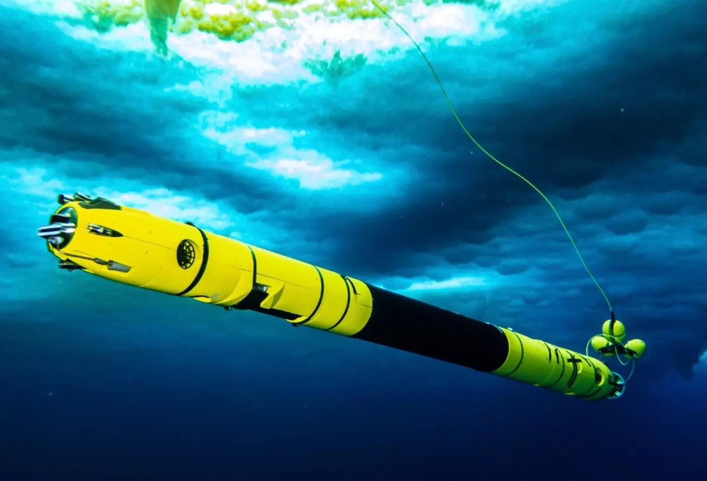

The team sent a robot down beneath the surface of the glacier to see what was going on. (Rob Robbins)
It also recorded vital pieces of date, including temperature and salt levels.
And sadly for us, it wasn’t great news, with fears growing that the rate of melting could lead to its collapse.
In a statement to CNN, lead researcher Peter Davis said it was ‘a very nuanced and complex picture’.
Even though the rate of melting wasn’t found to be as high as previous estimates, Davis said it wasn’t a time for complacency.
He said: “The glacier is still in trouble. What we have found is that despite small amounts of melting there is still rapid glacier retreat, so it seems that it doesn’t take a lot to push the glacier out of balance.”

Glaciers are melting at an alarming rate. (Ashley Cooper/Getty Images)
Speaking more recently, Christine Dow, an associate professor of glaciology at the University of Waterloo has said that they hope it’ll take at least 500 years for the Doomsday Glacier to melt.
“We really, really need to understand how fast the ice is changing, how fast it is going to change over the next 20 to 50 years,” she explained to Scientific American last month.
“We were hoping it would take a hundred, 500 years to lose that ice. A big concern right now is if it happens much faster than that.”
Featured Image Credit: Peter Davis/British Antarctic Survey/ITGC
Topics: Climate Change, Environment, Science, Antarctica
Niamh Shackleton

Inside the underground tunnel where no humans will be able to visit for 100,000 years
Deep underground in a European country bordering Russia lies a world’s first tomb
There’s a place which no humans will set foot in for a whopping 100,000 years in what will mark a world first.
To put that timeline into comparison, 100,000 years ago wooly mammoths still roamed the earth during the ice age while the first humans migrated in the harsh conditions, with many dying.
What the world will look like 100,000 years in the future is unknown – mankind may have left Earth already by then.
But if we have stuck around then we’ll finally be able to enter the underground tunnel in Finland where no humans can go for about 4,000 generations.
The northern European country, that borders Sweden and Norway as well as Russia, has built the world’s first geological tomb where it plans to bury spent nuclear fuel.
While it sounds terrifying, the nation has plaudits from around the globe claiming Finland to be ‘a model for the entire world’ for the sustainable storage of nuclear energy.
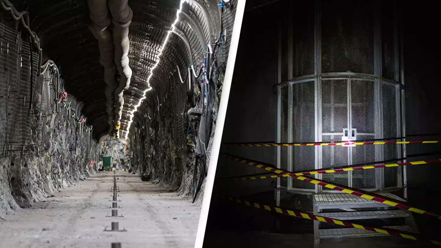
“A tour at Onkalo, which lies 450m (1,480ft) below the ground, to see tunnels hewn in the living rock to store highly radioactive waste for 100,000 years, suddenly makes me nervous,” writes BBC journalist Erika Benke who was offered a walk around the tomb.
A deposition hole, approximately 8m deep and 1.75 m in diameter, is pictured in the Repository in ONKALO, a deep geological disposal underground facility designed to safely store nuclear waste (JONATHAN NACKSTRAND/AFP via Getty Images)
In 2025, it will be closed off to the world and no humans will be allowed inside it for 100,000 years.
It is the brain child of the country’s waste management organization Posiva, which explained its plans to place the spent fuel in water-tight canisters which would then be placed in the Onkalo geologic repository.
Located in southwestern Finland, it can be found near to the Olkiluoto nuclear power plant.
Benke explained how she had to pass through a turnstile at a security gate before hopping into a car driven by her guide.
“It takes 15 minutes to drive down to Onkalo’s service station which lies 437m (1,430ft) below the ground. As the 4.5km-long (2.8 mile) tunnel begins to snake down, we see a standard traffic sign for a 20km/h (12mph) speed limit. There are also green signs on the tunnel wall at regular intervals indicating how far we are from the surface,” she writes.
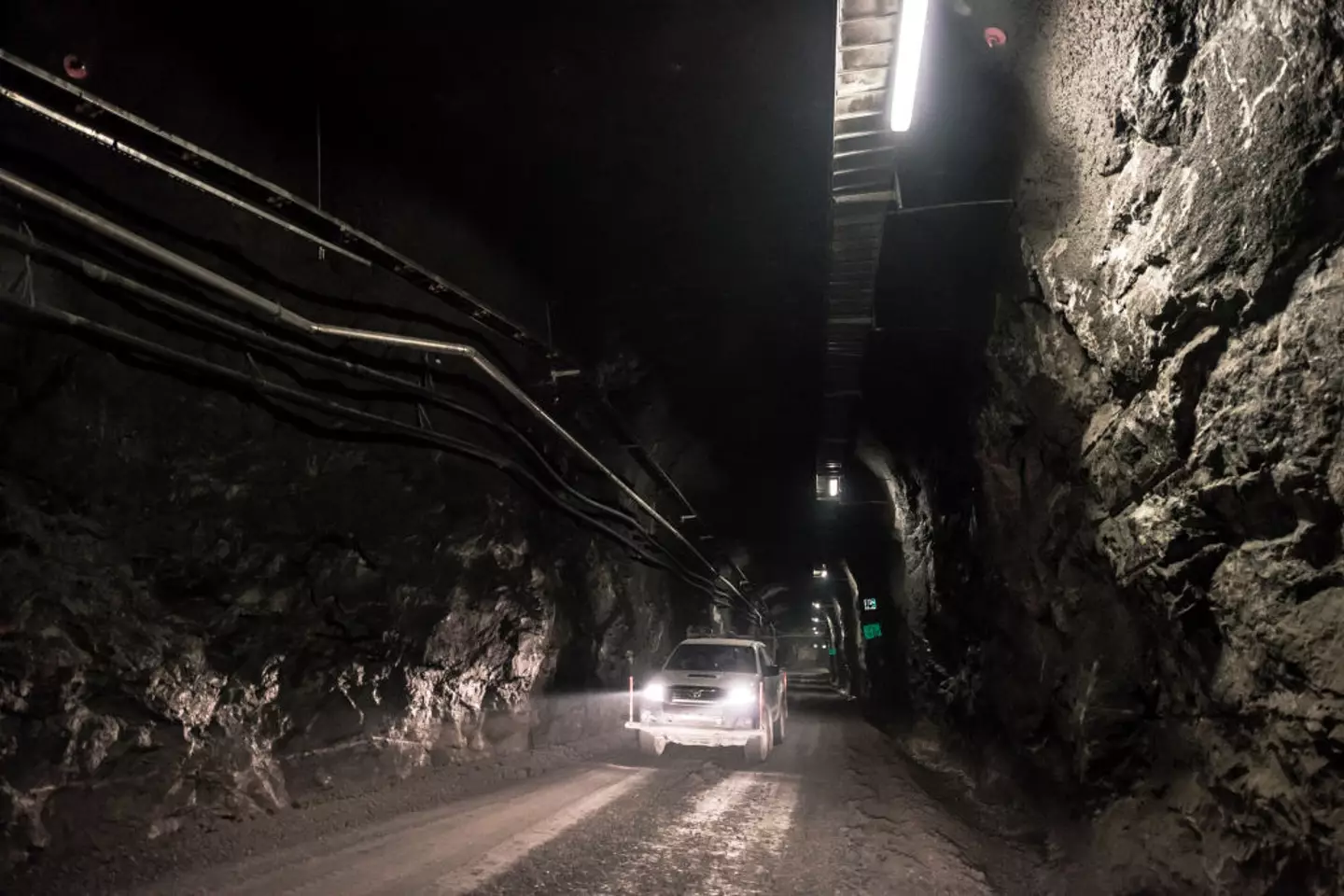
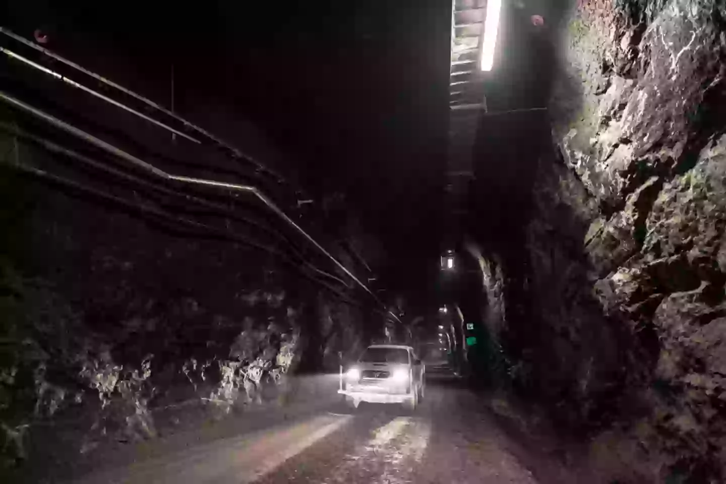
A car drives in the access tunnel of Posiva’s spent nuclear fuel repository Onkalo back in 2017 (Antti Yrjonen/NurPhoto via Getty Images)
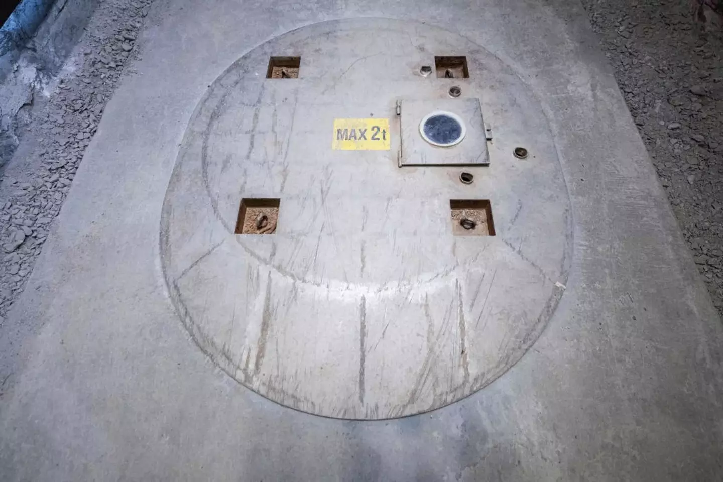
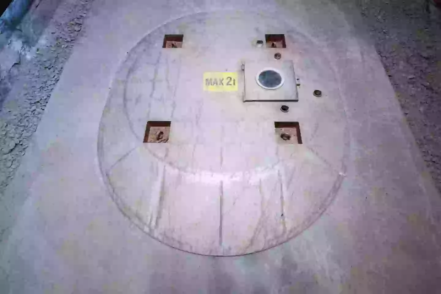
Benke went on to explain how the tunnel was narrow, only enough space for one car, and how the the nuclear waste canisters ‘will arrive at the service area in a lift running straight down from the encapsulation plant on the surface’.
Adding: “When the spent fuel starts being stored here, canisters will be lowered from this lift landing area further down to a deposition tunnel where they’ll be picked up by robotic vehicles to take them to vertical deposition holes – their final resting places.
“We’re shown a demonstration deposition tunnel. Its entrance is a lot darker than the service area and the floor is uneven and wet, muddy in places. The walls are bare bedrock that glints in the torchlight.”
And I guess from next year, the rest will remain a mystery…
Featured Image Credit: JONATHAN NACKSTRAND/AFP via Getty Images
Topics: Climate Change, World News, Europe
Joe Yates
Devastating impact oil tanker bursting into flames after colliding with cargo ship could have on environment
The vessels collided and made a ‘massive fire ball’ in the North Sea, around 10 miles off the coast of England
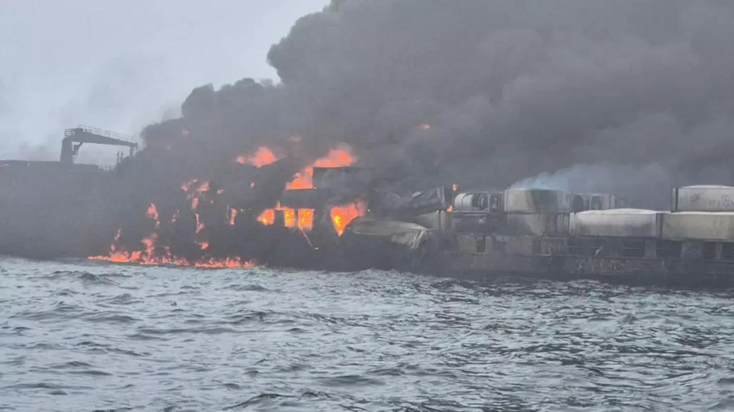
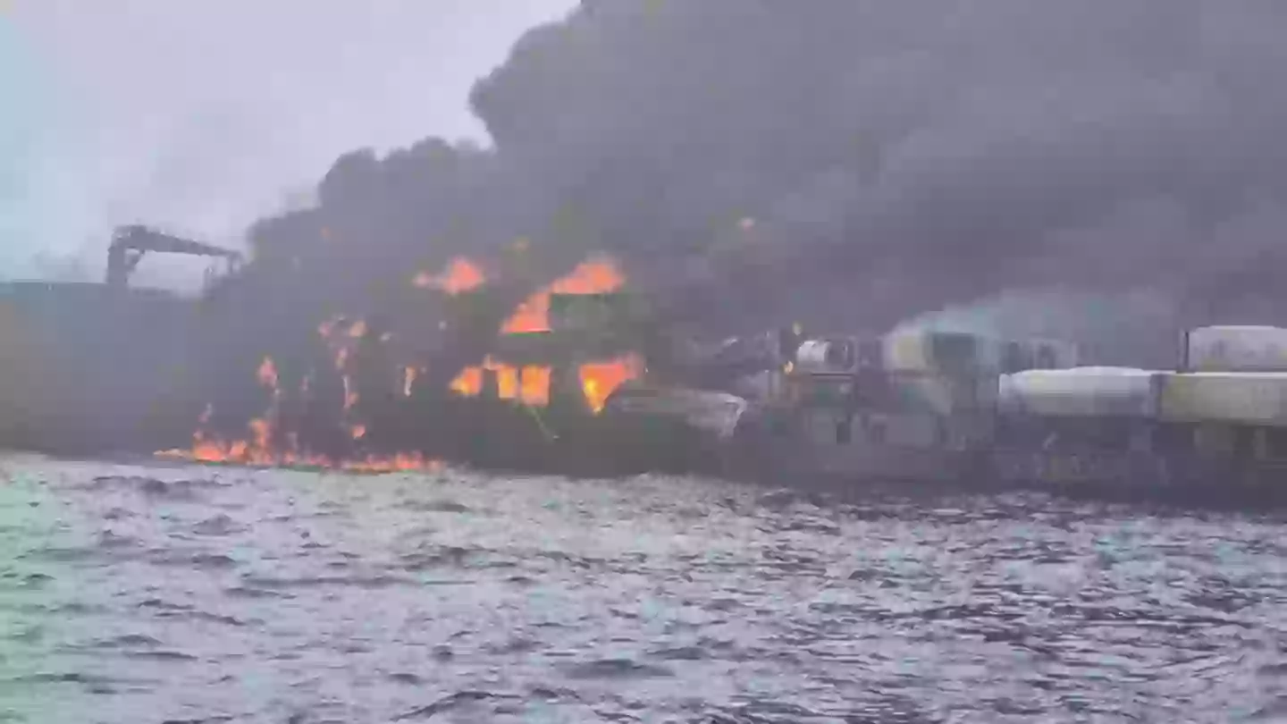
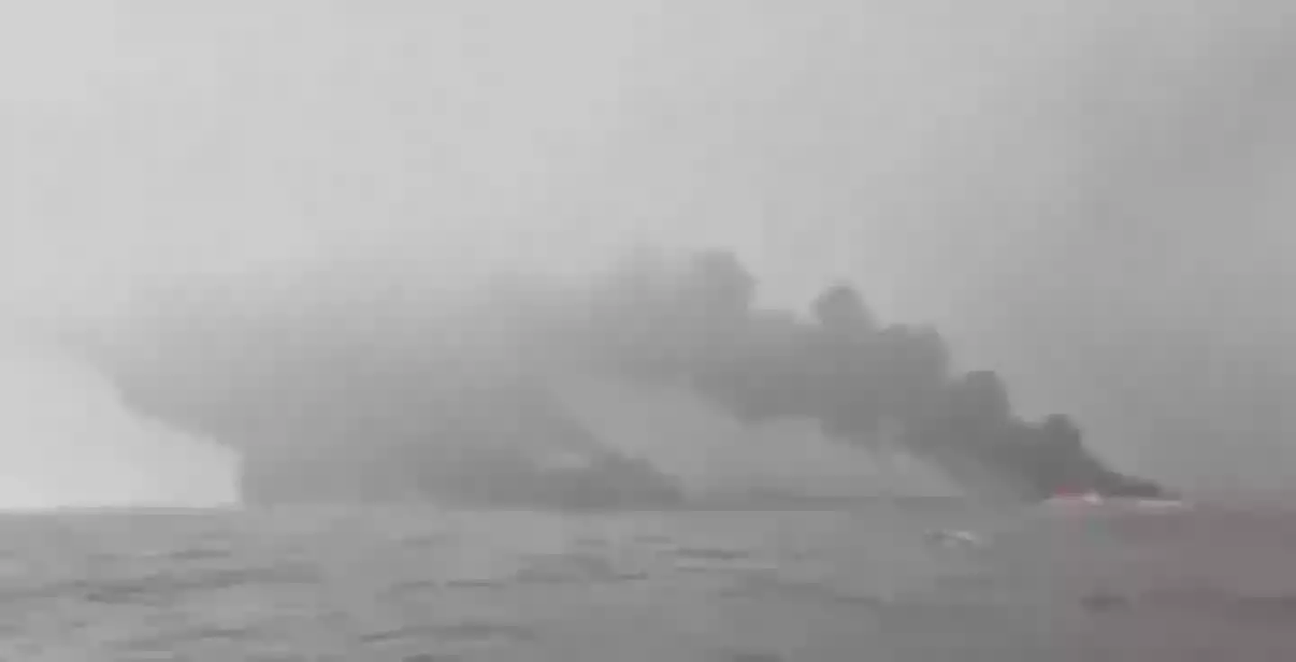
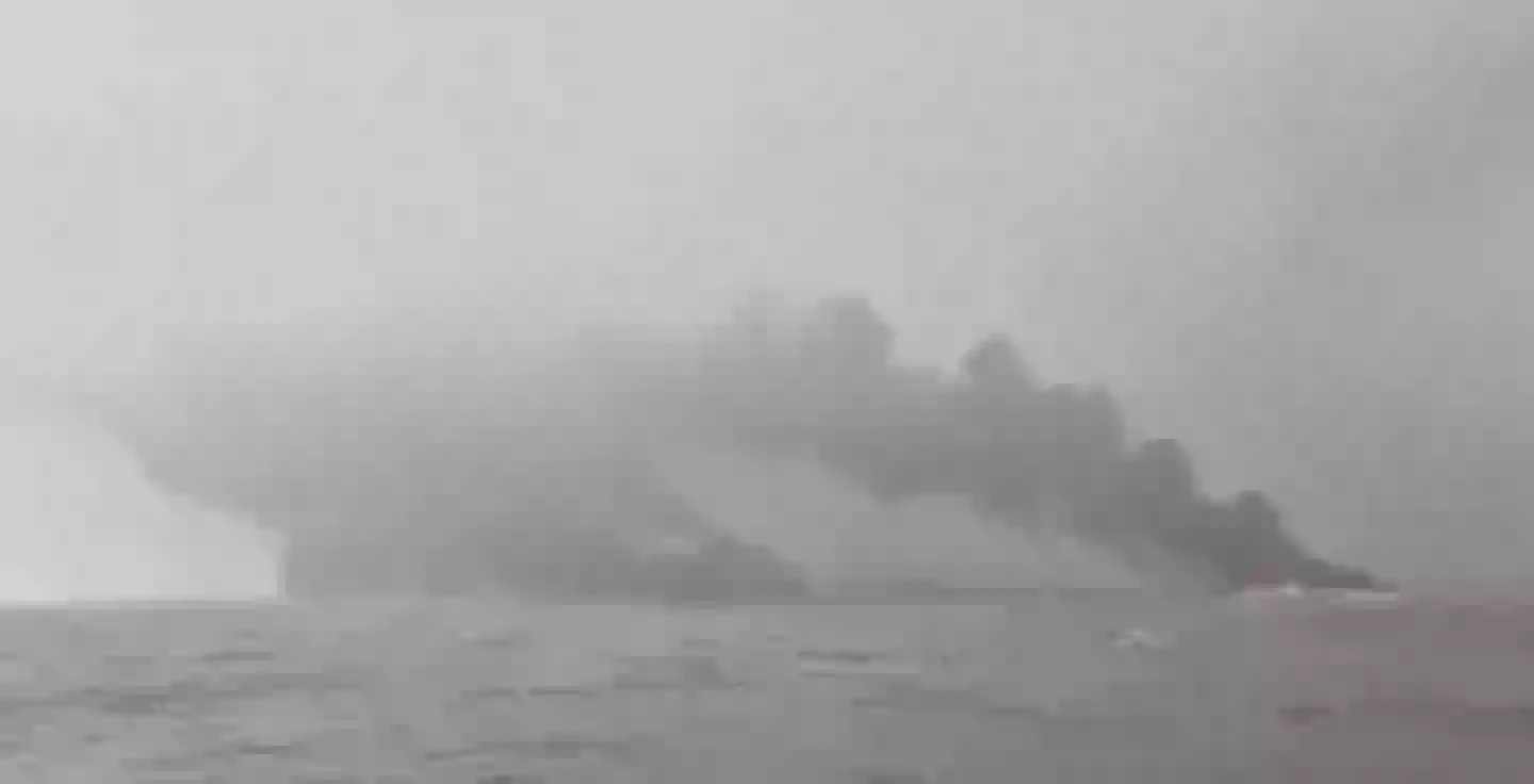
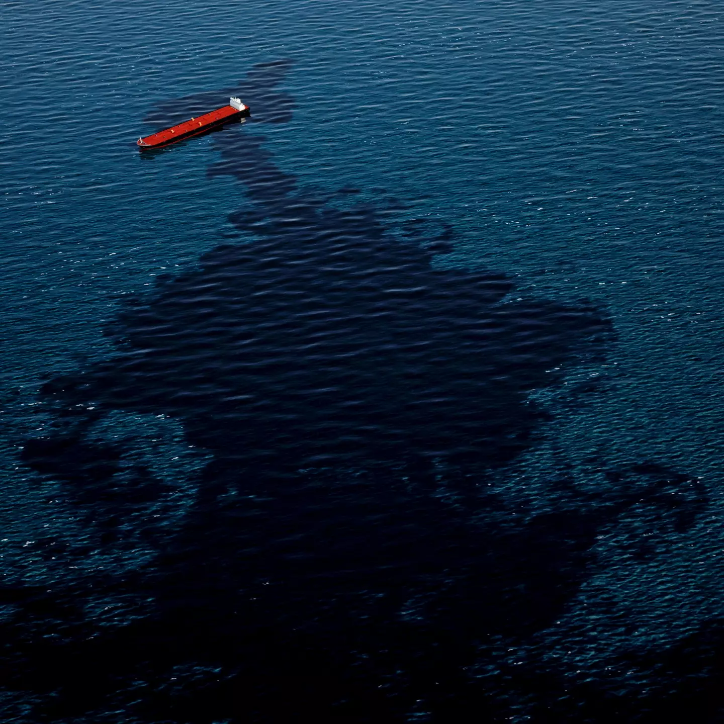
The oil tanker that collided with a cargo ship, which formed a ‘massive fire ball’ could have a devastating impact on the environment.
A major maritime rescue mission has been underway in the North Sea, around 10 miles off the coast of England today (March 10), after two vessels crashed into one another and caught fire.
HM Coastguard confirmed the incident took place near the Humber Estuary while crews raised the alarm at around 9.48am.
Crews abandoned the vessels after there was a ‘massive fireball’ (Twitter/@TheSecretFF999)
The crash reportedly involved the US-flagged Stena Immaculate and the MV Solong from Portugal, with the former traveling from Scotland to Rotterdam in the Netherlands when it allegedly careered into the stationary oil tanker.
While 37 casualties have been rescued from the waters around the burning wreckages which prompted a ‘massive fire ball’, it is feared the catastrophic collision could present irreversible ecological damage.
First of all, the oil tanker was believed to have been carrying Jet A1 fuel which a distress call revealed was ‘on fire and in the water’.
Large-scale oil spills can contaminate marine ecosystems, harming birds, sea life and coastal habitats.
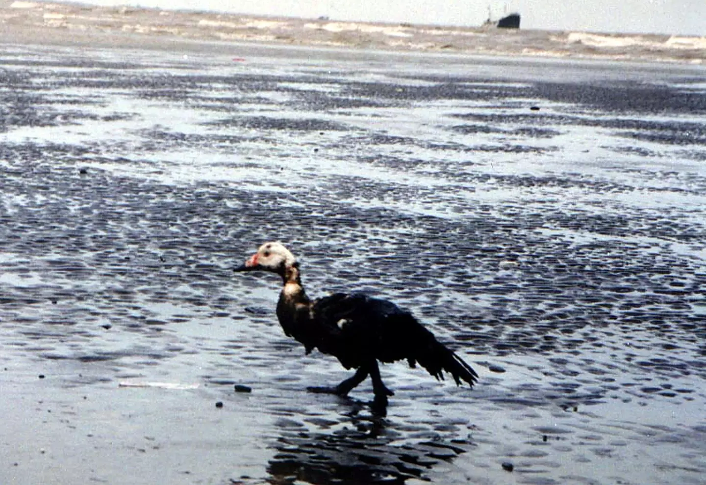
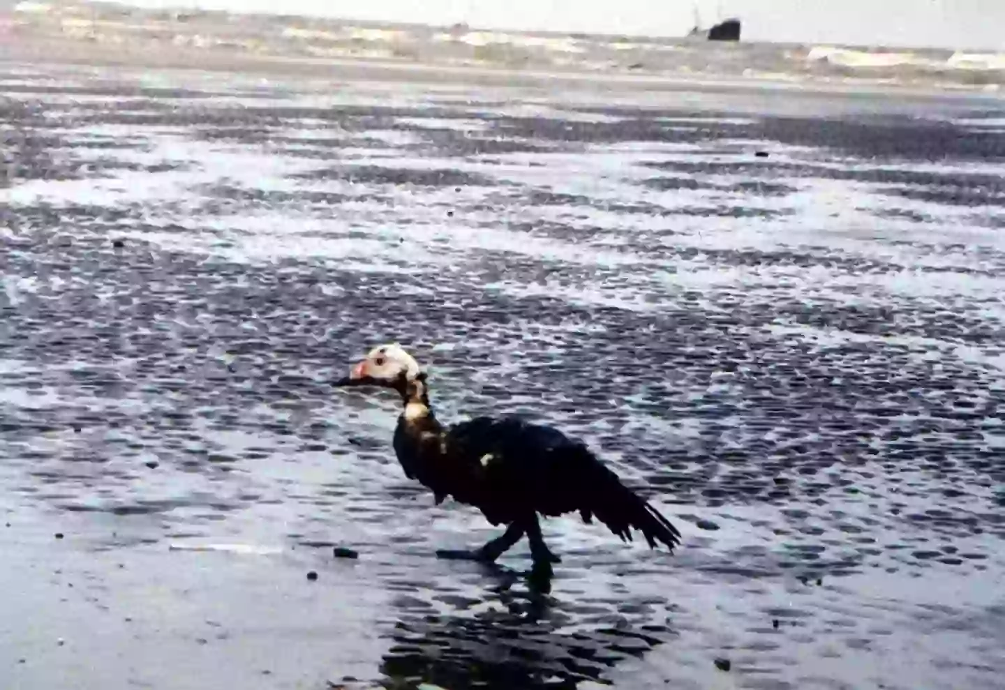
Sea life and birds can be directly harmed in oil spills (TATANG KIRANA/AFP via Getty Images)
The National Oceanic and Atmospheric Administration (NOAA) says on its website that cleanups can ‘never remove 100 percent’ of oil spilled in the water.
Wildlife experts say a major bird colony of Gannets close to the impact site will be adversely impacted by the spill, reports the Metro.
Dave O’Hara, senior site manager at RSPB Bempton Cliffs, commented: “We are extremely concerned about the potential for a leak from the tanker as oil pollution can seriously damage habitats and be lethal to seabirds.”
The Cleethorpes Wildlife Rescue committee has also set up a dedicated ‘oiled wildlife hotline’ to treat animals, mostly birds, that will be affected by the incident.
A BBC climate and science reporter further said previous oil tanker spills have been ‘responsible for some of the worst environmental disasters in the UK’. For instance, an incident in 1967 saw more than 100,000 tonnes of crude oil pollute the English Channel which killed thousands of sea birds.

Even with clean-up attempts, experts say not all of the oil from a spill can be fully removed (Getty Images)
The reporter added: “The size of the spill, weather and sea conditions, and the type of oil being carried play a big role in the outcomes for wildlife.”
And in the case of the 1967 SS Torey Canyon spill, it was carrying both crude and ‘persistent’ oil like marine diesel which ‘break up more slowly and can smother habitats and wildlife, affecting their ability to regulate their body temperature and can result in death.’
That, and both vessels being on fire and billowing black smoke into the atmosphere can present a short-term risk to wildlife like birds.
It is believed the US oil tanker was carrying jet fuel at the time of the collision (Twitter/@Tessaronnews)
Meanwhile, toxic light oils like diesel can kill animals that come into direct contact with them.
However, Greenpeace UK told the news outlet it is ‘too early’ to know the extent of the damage but stressed its ‘great concern’ having seen the speed of the collision and the fiery aftermath.
A spokesperson added: “Sea and weather conditions will also be important in determining how any spill behaves.
“In the case of an oil spill or any loss of hazardous cargo from the container ship involved, the speed of the response will also be crucial in limiting any impact.”
The UK Coastguard also said it is looking at what its counter-pollution response may be in the wake of the incident.
A UK Coastguard spokesperson said: “The incident remains ongoing and an assessment of the likely counter pollution response required is being enacted.”
Meanwhile, Environment Minister Baroness Hayman added: “We are speaking very closely in DEFRA (the Department for Environment, Food & Rural Affairs) to the Department for Transport and Maritime and Coastguard Agency, who are leading the Government response on this and who are at the moment assessing the situation.”
Featured Image Credit: @Tessaronnews/Twitter
Topics: Environment, US News, World News, UK News, Climate Change, Animals, Science
Liv Bridge

Scientists drilled to the bottom of the Great Blue Hole and uncovered worrying trend
The UNESCO World Heritage site can be used to show the devastating effect of climate change

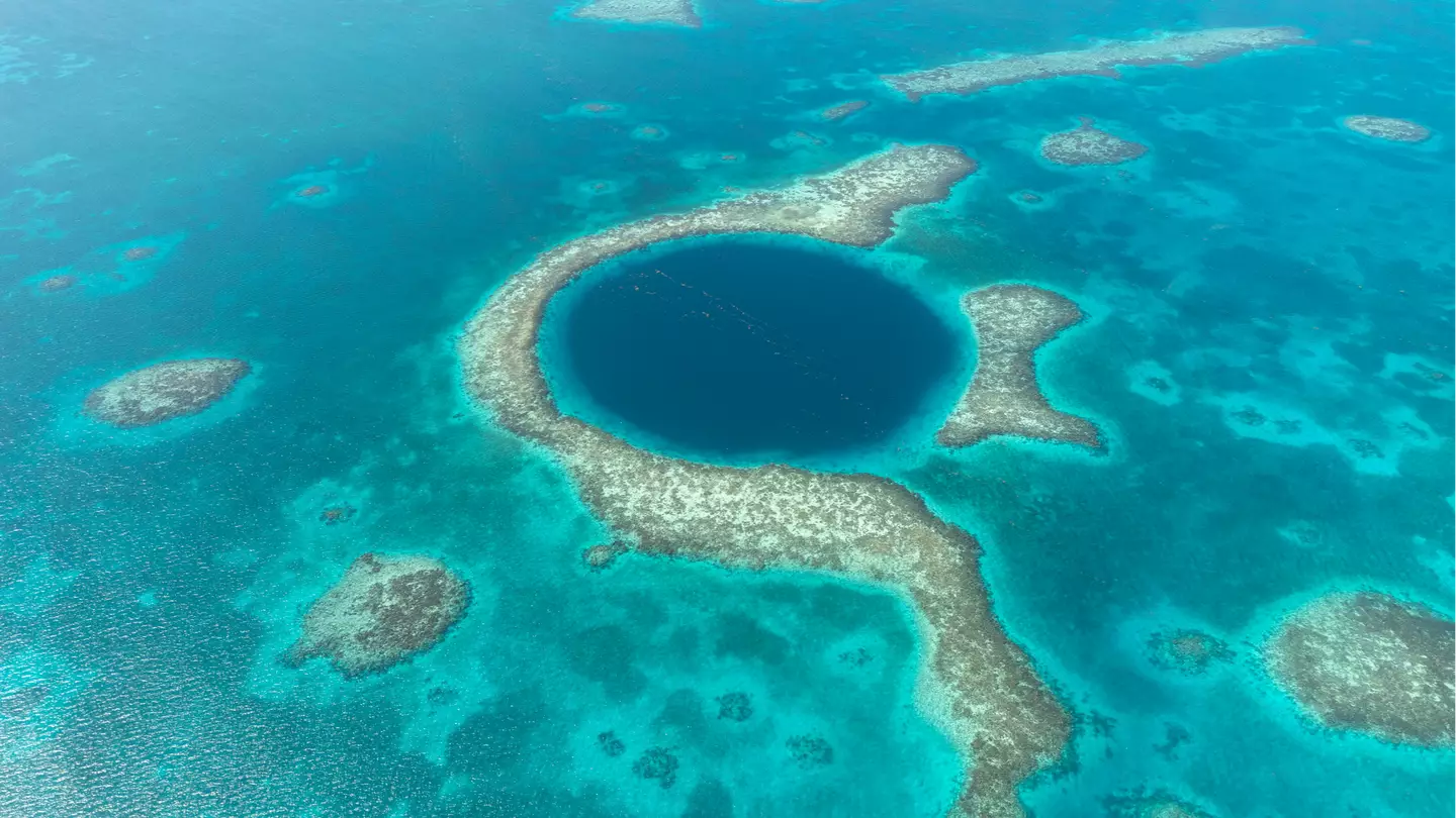
Experts have drilled to the bottom of the Belize Great Blue Hole, discovering an extremely ‘concerning’ tropical weather trend.
The Great Blue Hole is a large marine sinkhole situated around 43 miles from Belize City.
With a surface area of 760,500 sq ft, scientists believe the UNESCO World Heritage Site began to form around 153,000 years ago.
In recent years, the eye-catching geological feature has become a place that recreational scuba divers travel to and explore. However, explorers claim it’s much more than just a tourist attraction—it serves as an indicator that tropical cyclones in the Caribbean could increase in the coming decade.
On March 14, a new study was published in the popular Geology journal, entitled ‘An annually resolved 5700-year storm archive reveals drivers of Caribbean cyclone frequency’.
Researchers analyzed the sediment core, which measured 98 feet, to determine the exact number of tropical cyclones that had taken place over the past 5,700 years.
According to Live Science, two layers of fair-weather sediment are usually laid down every year. This enables researchers to essentially count back the years in a similar fashion to counting the rings of a tree.
After comparing when storm-event sediment layers were deposited, scientists discovered that tropical cyclones had been increasing in frequency for the past 5,700 years.
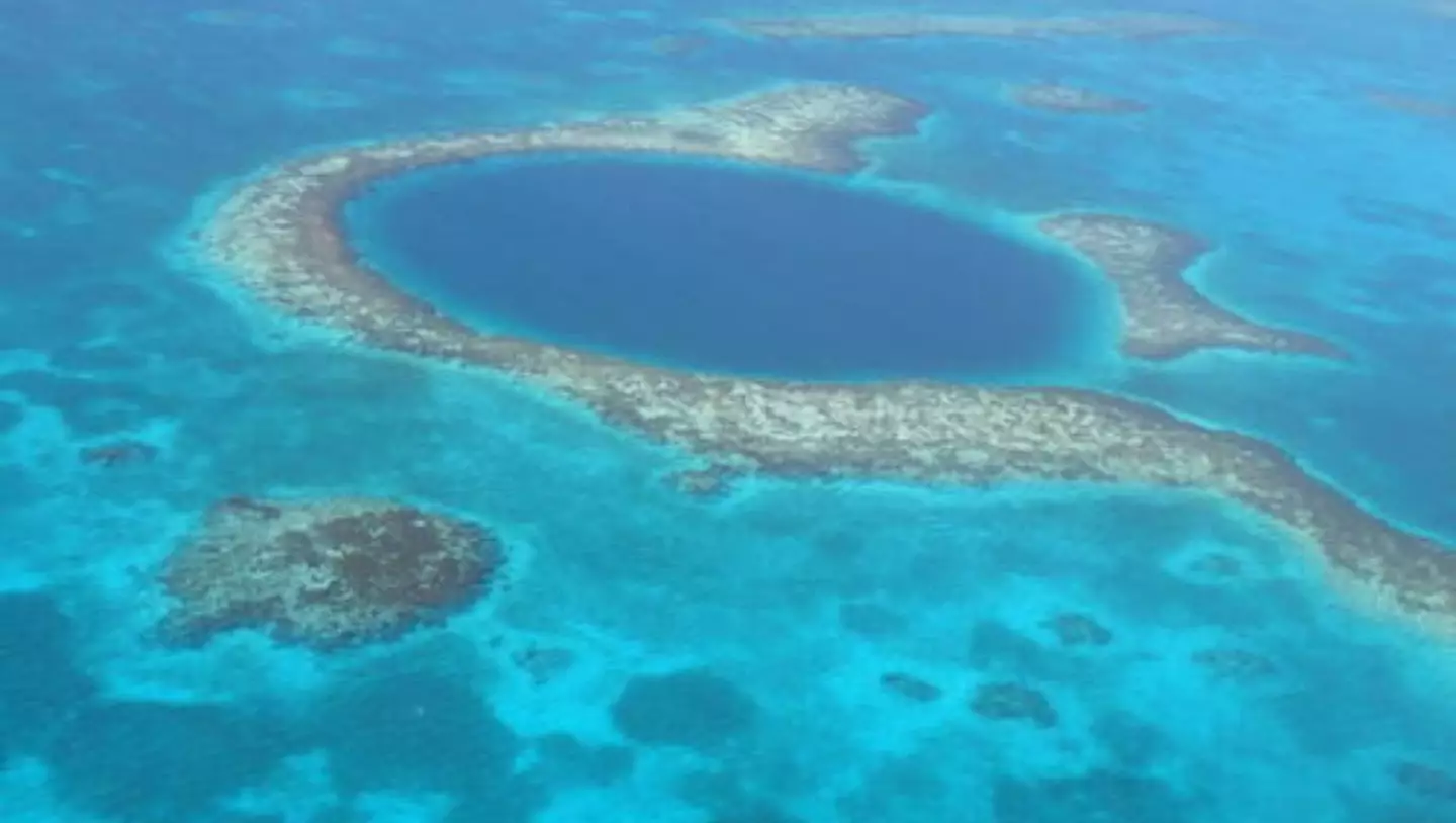

The Great Blue Hole shows the devastating impact of climate change (UNESCO)
An increase in the adverse weather phenomenon was also seen around the Industrial Revolution, which is when the world started burning fossil fuels.
“A key finding of our study is that the regional storm frequency has increased continuously since 5,700 years B.P. [before present],” study lead author Dominik Schmitt, a researcher at Goethe University Frankfurt’s Biosedimentology Research Group, told the publication.
“Remarkably, the frequency of storm landfalls in the study area has been much higher in the last two decades than in the last six millennia — a clear indication of the influence of Modern Global Warming.”
Schmitt went on to say that over the past six millennia, there have been between four and 16 tropical storms and hurricanes passing over The Great Blue Hole ‘every century’.
However, in the past two decades, researchers discovered evidence of nine tropical storms passing over the protected site.
.jpg)
.jpg)
The graph shows how storm frequency in the Great Blue Hole has increased in 100-year windows (Schmitt et al.)
“The nine modern storm layers from the last 20 years indicate that extreme weather events in this region will become much more frequent in the 21st century,” Schmitt added.
The study claims that rising global sea surface temperatures, caused by climate change, are likely responsible for the recent spike in tropical storms.
Another reason for the spike could be stronger global La Niña events, which are known to lead to other natural disasters like drought and flooding.
Worryingly, the specialists also believe another 45 tropical storms, hurricanes and cyclones could hit the Caribbean before the end of 2100.
“This high number is far in excess of what has been the case in the past 5,700 years,” Schmitt said.